
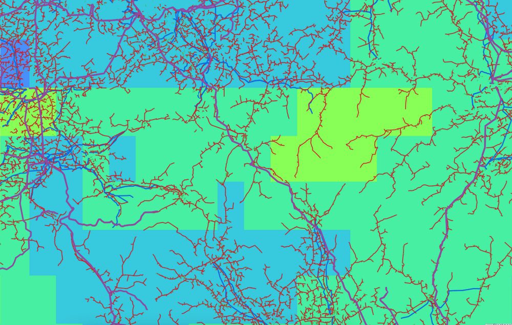

Smart electric grid
Self-service satellite analytics for energy, environment and infrastructure

Commercialised by
Spottitt
Harwell, Oxford, United Kingdom
Electron Building, Fermi Ave , OX11 0QR Harwell, Oxford, United Kingdom


The need
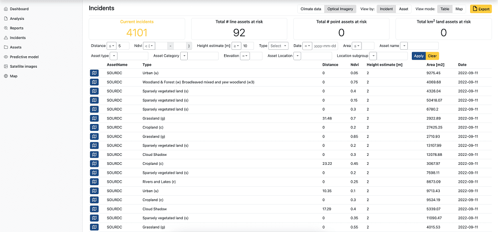
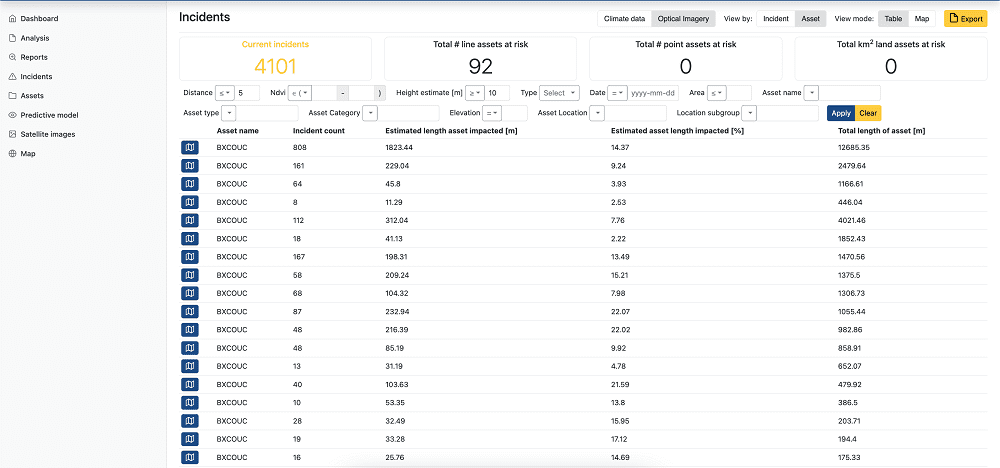
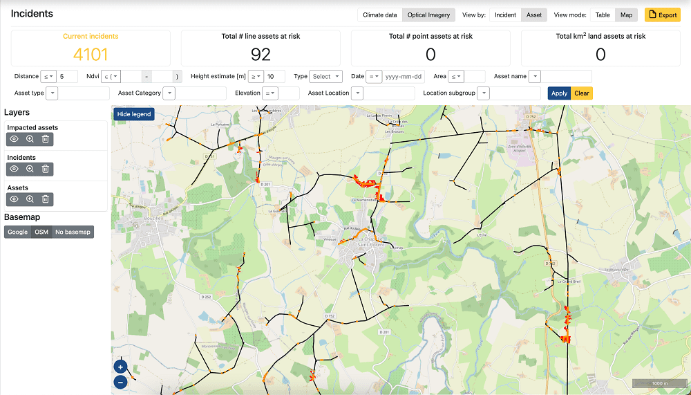
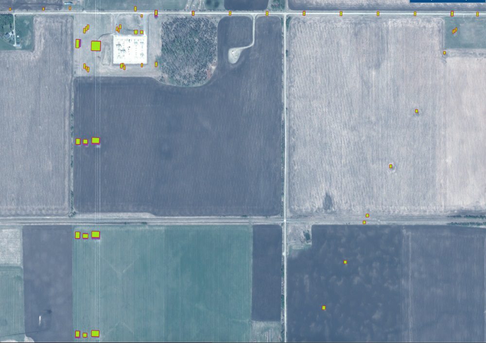
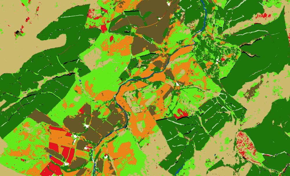
Utilities and infrastructure owners need geospatial data to optimise their assets’ design, construction, operation, and maintenance. However, data from satellites, drones and other sensors come in different forms, making it challenging to leverage the generated insights.
The solution
AI-powered geospatial analytics that leverage satellite, climate, and other data sources. The platform captures raw geospatial data and transforms it into actionable insights to support asset managers throughout the entire lifecycle of the asset, from site selection and route planning to monitoring construction progress, vegetation, third-party works, land movements, climate conditions, and biodiversity.
The value proposition